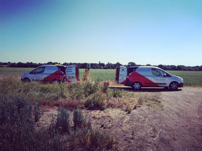
CD Surveys Ltd Land & Building Surveyors In Sunbury on Thames
CD Surveys Ltd provides extensive services, including Measured Building Surveys, Topographical Surveys, Site Engineering Comprising Land Surveys, Section 38/104/278 Adoption Surveys, and CAD Services (Computer-Aided Design).
Since establishing CD Surveys Ltd in 1992, we have been committed to putting our customers at the forefront of everything we do.
Clients across the city value our professionalism, unwavering support, and exceptional after-sales service. As a result, many of them continue to trust us for their surveying needs. They don’t mind recommending our services to others, enabling us to establish long-lasting business relationships.
Get In Touch With Us!
Head Office
The Office
113 Church Street,
Staines Upon Thames,
TW18 4XZ
Phone
Do you need a quote for a survey?
Feel free to contact us by clicking here to complete the brief online form.
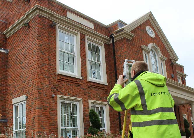
Precision Matters: Discover the Difference with Our Land Surveying Services in Sunbury on Thames
We are proud to offer top-notch professional land surveying services in Sunbury on Thames. Our experienced team provides comprehensive services, including land surveys, topographical surveys, measured building surveys, site engineering, section 38/104/278 adoption surveys, and CAD services.
We understand the importance of accuracy and precision in land surveying and use state-of-the-art technology and equipment to ensure our results are of the highest quality. Our team of surveyors has extensive knowledge and expertise in the field, and we are committed to delivering exceptional service to all our clients.
We take pride in our customer-focused approach and strive to exceed our client’s expectations. Our team provides a smooth and efficient service, from initial consultation to final delivery of the survey report. We believe that communication is critical, and we keep our clients informed throughout the process.
Whether you need a land survey for a small residential property or a large commercial project, we are here to help. Our services are tailored to meet your specific needs and requirements. We remain committed to delivering results that meet or exceed your expectations.
Contact us today to learn more about our professional land surveying services in Sunbury on Thames.
We Offer A Variety Of Land Surveys
CD Surveys Ltd Land & Building Surveyors has extensive experience running all types of surveys. Here is a brief list of the land surveying work we do in Sunbury on Thames:
Topographical Surveys
Recording and measuring the terrain is the primary objective of our topographical surveys. Our surveys cover an array of features such as kerbs, boundary demarcations, walls, fences, service covers, pylons, and roads. We provide data in both 2D and 3D formats to meet your specific needs. Our team utilizes advanced equipment and technology to ensure the highest accuracy and reliability.
Boundary Surveys
We specialize in boundary surveys that provide crucial data to help settle disputes related to property boundaries. We offer professionals accurate information needed to make informed decisions. Our team consists of highly skilled professionals with extensive knowledge and expertise in land surveying. We are committed to delivering exceptional service to our clients, ensuring that their needs are met and their expectations are exceeded.
Long And Cross-Sections
We offer the provision of long and cross-sections from ditch or river surveys, preferably from a digital terrain model (DTM) of the site. This data can be used to calculate flows and volumes in a hydraulic model. Our team uses advanced technology and equipment to ensure accurate and reliable results.
Contour Surveys
Contours are used to depict the “undulations” on the surface of any land or elevations in the site or area in question. These are typically shown at quarter or half-meter intervals related to the site or Ordnance Survey Grid System and height datum. On elevations, contours can show irregularities with the contours depicted at 5-10mm and could show “sags or bulges” in the facade or structure. At CD Surveys, we can process data supplied by ourselves or a third party and present it as a fully edited three-dimensional Digital Terrain Model (DTM). This model is perfect for Engineering Design on Microstation MX (MOSS) or the PDS design systems.