OS GPS and GNSS Land Surveying
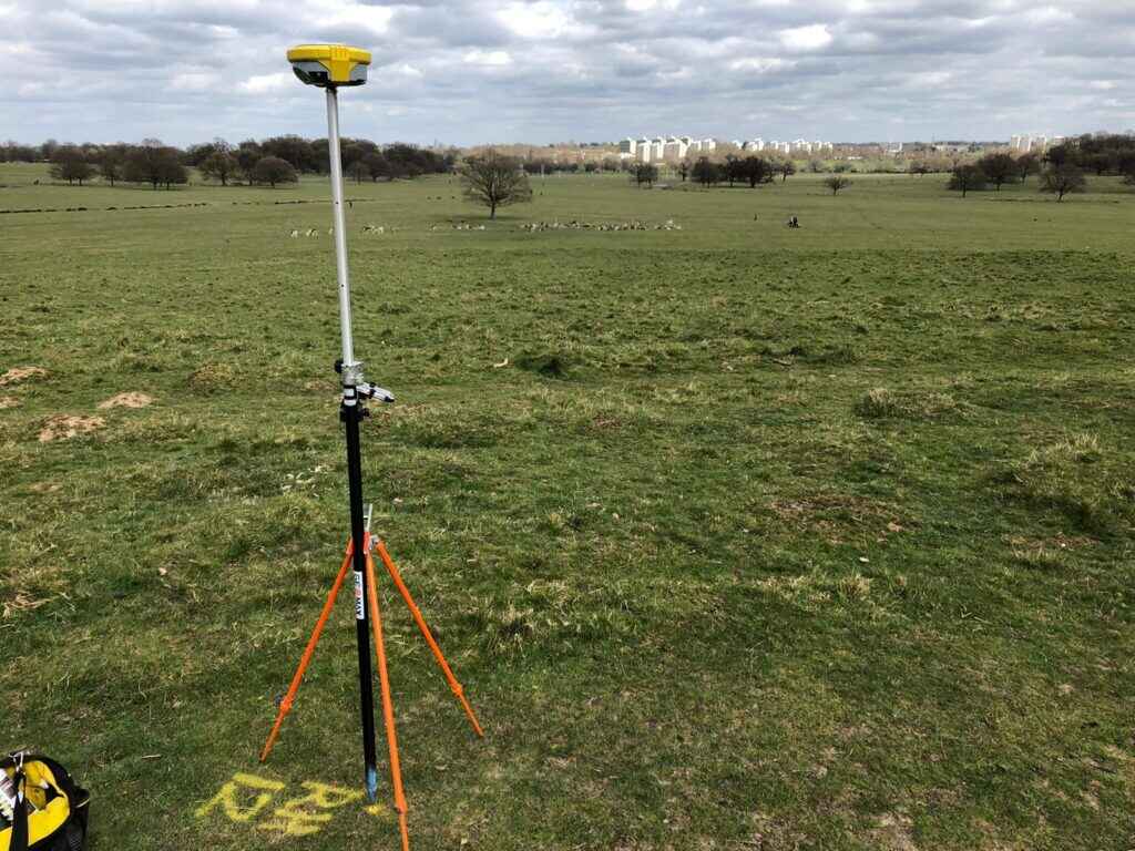
GNSS (Global Navigation Satellite Systems) surveying is the most advanced positioning technology available to land surveyors today. It provides precise location and data recording by using multiple satellite constellations, including land surveying using GPS (Global Positioning System).
Using an international network of satellites from the US, Russia, Europe, and China, a receiver can accurately pinpoint the horizontal and vertical position of any feature. Generally, a minimum of five satellites is needed at any given time for this initial positioning. Internal receiver software then processes these satellite signals to provide data with sub-centimetre accuracy.
This data can be related either to the OS National Grid Coordinate system or to your project’s own Local Grid. The recorded data can be processed and manipulated by various software applications, depending on client requirements.
Once processed, the data is delivered to the project team in multiple formats so they have the most accurate information available. The system is set up and managed by the U.S. military, and it currently uses about 30 orbiting satellites. These satellites transmit signals that are received by GPS surveyors devices on the ground. By using signals from several satellites, these receivers can calculate their position with sub-millimetre accuracy, depending on the specific equipment.
GPS Surveying for Civil Engineering and Construction
GPS surveying technology is a versatile and effective solution for civil engineering and construction. Its user-friendly design and compatibility with various software applications make it a complete and accurate tool for professionals. The ability for a single surveyor to work independently on-site increases productivity and efficiency.
To ensure the final data is reliable and meets project requirements, verification is critical. This can be achieved by taking multiple readings over a period of time or by cross-verifying the data with conventional surveying techniques.
Why CD Surveys for your GNSS Land Surveying Needs?
At CD Surveys, we are proud to be labelled as highly reputable and reliable GPS land surveyors. Our extensive knowledge, experience and unmatched skills in land surveying using GPS allow for fast and efficient work from our team.
Whether you are searching for GNSS surveying for commercial or local purposes, you’ve come to the right place!
LAND SURVEYING SERVICES
Professional Land Surveying Services You Need
why choose us
We are Professional Land Surveyors

Client Satisfaction
We’re committed to providing 100% satisfaction

Our Vision & Mission
Surveying is our passion