GPS Survey Services in Sunbury-on-Thames by CD Surveys Ltd Land & Building Surveyors
Sunbury-on-Thames, a charming town located in Surrey, United Kingdom, is renowned for its picturesque landscapes and rich history. Amidst the beauty of this thriving location, CD Surveys Ltd Land & Building Surveyors proudly offers cutting-edge GPS surveying services, elevating land surveying to new heights of accuracy and efficiency.

Get In Touch With Us!
Head Office
CD Surveys Ltd Land & Building Surveyors
The Stables,
Pentire, Fordingbridge Road,
Sunbury-on-Thames TW16 6AX,
United Kingdom
Phone
Do you need a quote for a survey?
Feel free to contact us by clicking here to complete the brief online form.
Unravelling the Power of GPS Surveying Technology
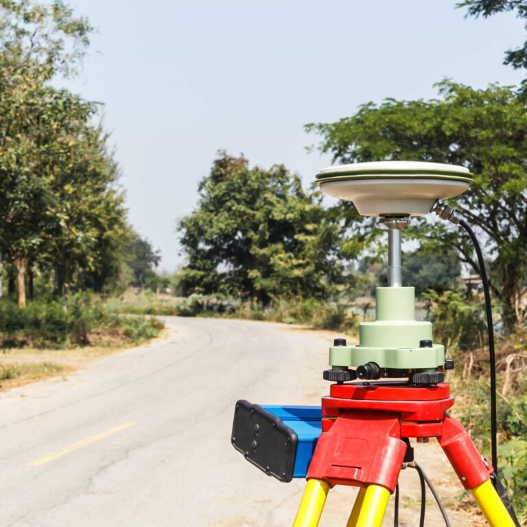
CD Surveys Ltd brings the most advanced GPS surveying technology to Sunbury-on-Thames, empowering construction and civil engineering projects with unparalleled precision. Our team of expert surveyors, armed with state-of-the-art GPS equipment, ensures that every point and feature is accurately measured with sub-centimeter precision.
With access to signals from the US, Russia, Europe, and China’s satellite constellations, our GPS receivers provide reliable and real-time positioning data. Whether you need horizontal or vertical positioning, our GPS surveying services offer unrivaled accuracy, meeting the highest industry standards.
GPS Survey: Redefining Land Surveying
In the realm of land surveying, GPS technology has revolutionized the way data is captured and processed. With CD Surveys Ltd’s GPS survey services in Sunbury-on-Thames, surveyors can perform tasks with greater efficiency, independence, and productivity. The versatility of GPS technology allows it to be adapted to various software applications, providing surveyors with an all-in-one surveying tool.
Our dedication to precision extends to the processing and manipulation of survey data. The data captured during GPS surveys can be related to the OS National Grid Coordinate system or project-specific Local Grids, ensuring seamless integration with your existing project parameters.
We Offer A Variety Of Land Surveys
CD Surveys Ltd Land & Building Surveyors has extensive experience running all types of surveys. Here is a brief list of the land surveying work we do in Sunbury on Thames:
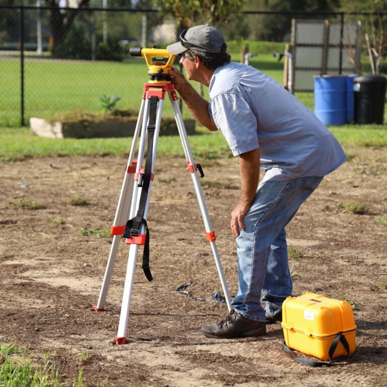
Topographical Surveys
Recording and measuring the terrain is the primary objective of our topographical surveys. Our surveys cover an array of features such as kerbs, boundary demarcations, walls, fences, service covers, pylons, and roads. We provide data in both 2D and 3D formats to meet your specific needs. Our team utilizes advanced equipment and technology to ensure the highest accuracy and reliability.
Boundary Surveys
We specialize in boundary surveys that provide crucial data to help settle disputes related to property boundaries. We offer professionals accurate information needed to make informed decisions. Our team consists of highly skilled professionals with extensive knowledge and expertise in land surveying. We are committed to delivering exceptional service to our clients, ensuring that their needs are met and their expectations are exceeded.
Long And Cross-Sections
We offer the provision of long and cross-sections from ditch or river surveys, preferably from a digital terrain model (DTM) of the site. This data can be used to calculate flows and volumes in a hydraulic model. Our team uses advanced technology and equipment to ensure accurate and reliable results.
Contour Surveys
Contours are used to depict the “undulations” on the surface of any land or elevations in the site or area in question. These are typically shown at quarter or half-meter intervals related to the site or Ordnance Survey Grid System and height datum. On elevations, contours can show irregularities with the contours depicted at 5-10mm and could show “sags or bulges” in the facade or structure. At CD Surveys, we can process data supplied by ourselves or a third party and present it as a fully edited three-dimensional Digital Terrain Model (DTM). This model is perfect for Engineering Design on Microstation MX (MOSS) or the PDS design systems.
Location-Specific Expertise
CD Surveys Ltd has established itself as a prominent surveying company in Sunbury-on-Thames, delivering exceptional services to clients across the region. Our team’s in-depth knowledge of the local terrain and regulations allows us to navigate even the most complex projects seamlessly. From residential developments to commercial constructions, our GPS surveying services are tailored to meet the unique requirements of Sunbury-on-Thames. As the go-to GPS surveying experts in Sunbury-on-Thames, CD Surveys Ltd is committed to exceeding your expectations. Whether you are embarking on a new construction project, need accurate topographical surveys, or require comprehensive site engineering solutions, our team is ready to assist you.