OS GPS and GNSS Land Surveying
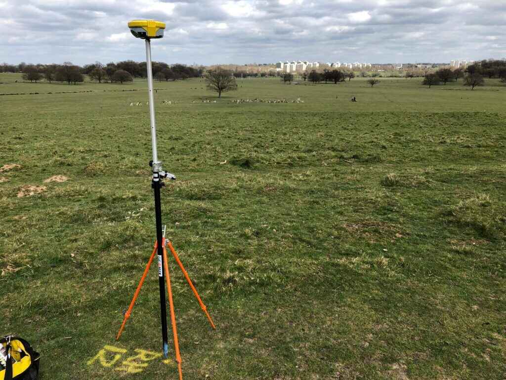
GNSS (Global Navigation Satellite Systems) surveying is one of the most advanced positioning technologies available to land surveyors today. It delivers highly precise positioning and reliable data capture by combining multiple satellite constellations, including land surveying using GPS (Global Positioning System).
Using an international network of satellites operated by the US, Russia, Europe, and China, a receiver can accurately pinpoint the horizontal and vertical position of any feature on site. In most cases, a minimum of five satellites is required to establish an initial position. Internal receiver software then processes these satellite signals to produce data with sub-centimetre accuracy, making GNSS survey methods highly effective across a wide range of projects.
This data can be referenced either to the OS National Grid Coordinate System or to a project-specific Local Grid. Once collected, the information is processed and adjusted using specialist software depending on client requirements.
After processing, the data is supplied to the project team in multiple formats, giving stakeholders access to highly accurate and usable information. The system is set up and managed by the U.S. military, and it currently uses about 30 orbiting satellites. These satellites transmit signals that are received by GPS surveyors devices on the ground. By using signals from several satellites, these receivers can calculate their position with sub-millimetre accuracy, depending on the specific equipment.
GPS Surveying for Civil Engineering and Construction
A land survey using GPS is an efficient and highly versatile solution for civil engineering and construction projects. The technology is easy to integrate with multiple software platforms, making GNSS land surveying a practical and dependable choice for professionals requiring accurate site data.
Because one surveyor can often operate independently on site, productivity and efficiency are significantly improved. To ensure reliability, survey results are always verified through repeated observations or cross-checked against conventional surveying techniques where required.
Why CD Surveys for your GNSS Land Surveying Needs?
At CD Surveys, we are proud to be labelled as highly reputable and reliable GPS land surveyors. Our extensive experience in GNSS land surveying, combined with specialist equipment and technical expertise, allows us to complete every GNSS survey quickly, accurately and efficiently.
Whether you require GPS surveying for commercial developments or local site work, our experienced team is ready to help.
LAND SURVEYING SERVICES
Professional Land Surveying Services You Need
why choose us
We are Professional Land Surveyors

Client Satisfaction
We’re committed to providing 100% satisfaction

Our Vision & Mission
Surveying is our passion